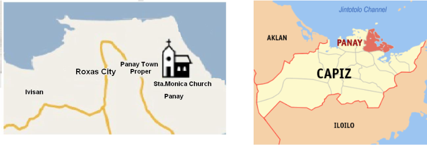
Panay is one of the 16 municipalities in the Province of Capiz located in the Region VI, Western Visayas with coordinate 11 28'55.79" latitude, 112 47'46.30" longitude, 11 36'28.74" latitude, and 122 47'59" longitude. It is along the coastal areas of Northern Panay Island with Roxas City on the northwest, Sibuyan Sea on the northeast, the Municipality of Pontevedra and Panitan on the south, and the Visayan Sea on the southeast
Map of Panay
How to get there!
Panay is accessible through any land transportation passing the Capiz
East Road. From Roxas City, it can be reached via jeepney, tricycle or
car in 15 minutes (7.5 km). From Iloilo, it takes about 2 hours and 30
minutes by bus or van (135 km) while from Kalibo, Aklan, it takes about
an hour (92 km). From Manila, it takes 45 minutes by airplane to reach
Roxas City Airport and 18 hours by ship to reach Culasi Port (1,600 km).
